Mapping Singapore: 1819 - 2014
Mapping Singapore: 1819–2014
Grace Ho 3 years ago 1 min. read
This fascinating essay detailing the history of mapping in Singapore between 1819 and 2014 was written by Mr Mok Ly Yng, a Fellow of the Royal Geographical Society, one of Singapore’s leading map consultants and a regular visitor at the National Archives.The essay was published as a chapter in National Library Board’s “Visualizing Space: Maps of Singapore and the Region” (2015) publication. The full essay from the book is shared here with the kind permission of Mr Mok and National Library Board:
[Please click to read the a PDF copy of the essay]: Visualising Space_Ch3. Mapping Singapore 1819 – 2014 by Mr Mok Ly Yng
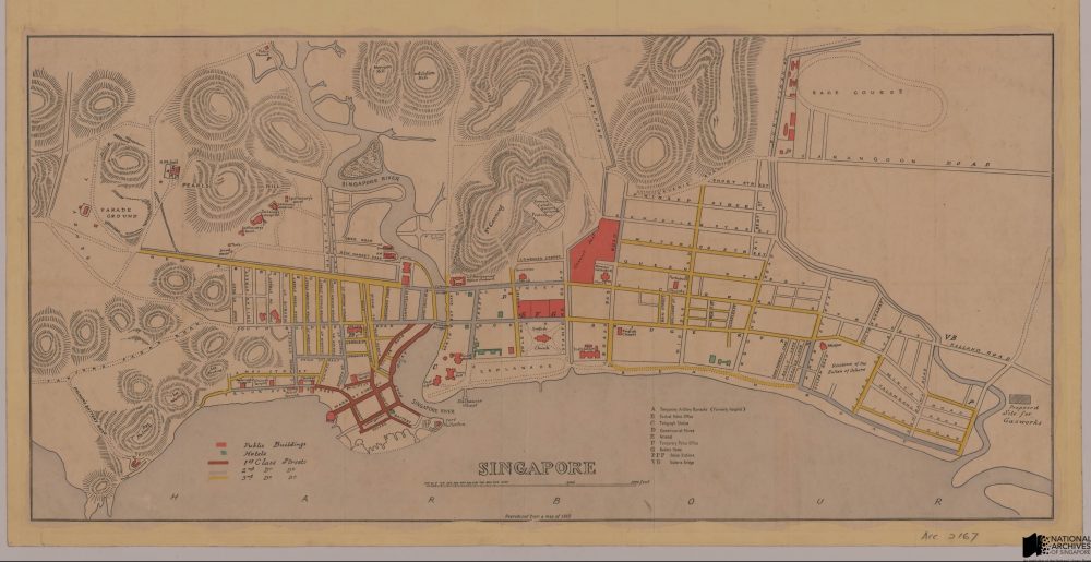
 A colored reproduction of a map of Singapore town, 1862. The map was drafted by Jules M. Moniot, who was the first Surveyor General of the Straits Settlements, appointed in 1855 (Source: URA, Acc: SP006422)

